
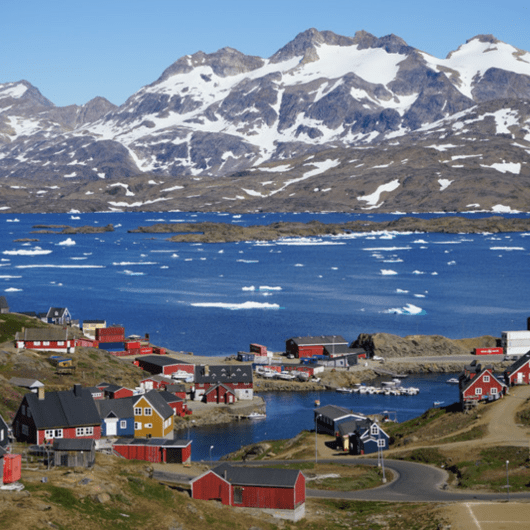
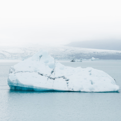
Greenland is a country that is hit heavily with climate change. Three-quarters of Greenland is covered by the only permanent ice sheet outside Antarctica. It is the least densely populated territory in the world. Greenland is the size of Mexico and yet has only 56,000 residents and 75 miles of roads. More than 80 percent of the landmass is covered by ice, in some places two miles thick.
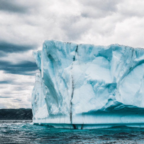
Some people consider Greenland the “ground zero” of climate change. As time goes on, more and more glaciers are at risk of melting. The amount that warm water around the island is contributing to the loss of the Greenland ice sheet. Between 2002 and 2016 the ice sheet lost mass at a rate of around 269 gigatonnes per year. One gigatonne is one billion tonnes. During the same period, the ice sheet also showed some unusual short-term behaviour. The 2012 melt season was especially intense – 97% of the ice sheet experienced surface melt at some point during the year. Snow even melted at its summit, the highest point in the center of the island where the ice is piled up more than 3 km above sea level.
Arctic permafrost contains more than 1,500 billion tonnes of dead plants and animals (around 1,500 billion walrus equivalent) which we call “organic matter”. Right now, this stuff has been frozen for thousands of years. But when the permafrost thaws this organic matter will decay, releasing carbon and methane (another greenhouse gas) into the atmosphere.
If thawing continues, it’s estimated that by 2100 permafrost will emit 850-1,400 billion tonnes of CO₂ equivalent (for comparison: total global emissions in 2012 was 54 billion tonnes of CO₂ equivalent). All that extra methane and carbon, of course, has the potential to enhance global warming even further.
“These results suggest that Greenland’s ice is more threatened by changing climate than we had anticipated.”
– Josh Willis of NASA’s Jet Propulsion Laboratory; he is the Principal Investigator of NASA’s Oceans Melting Greenland mission
New maps reveal that two to four times more oceanfront glaciers extend deeper than 600 feet (200 meters) below sea level than earlier maps showed. That’s bad news, because the top 600 feet of water around Greenland comes from the Arctic and is relatively cold. The water below that comes from farther south and is 6 to 8 degrees Fahrenheit (3 to 4 degrees Celsius) warmer than the water above. Deeper-seated glaciers are exposed to this warmer water, which melts them more rapidly.
Mathieu Morlighem’s team at UC Irvine used the maps to refine their estimate of Greenland’s total volume of ice and its potential to add to global sea level rise, if the ice were to melt completely — which is not expected to occur within the next few hundred years. The new estimate is higher by 2.76 inches (7 centimeters) for a total of 24.34 feet (7.42 meters).
Greenlanders themselves seem torn about climate change. Some say melting ice will expose land for oil drilling, mineral exploration and food production. “One positive thing is that in south Greenland the climate is getting warmer, and we are looking more into how we can create our own crops,” says Malik Milfeldt, of the Greenland Tourism and Business Council.
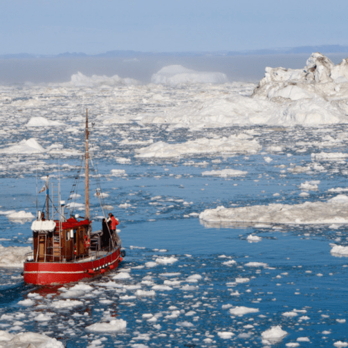
But tourism might be just the thing to get the world to take global warming seriously, says Milfeldt: “If people come to Greenland and see how much the glaciers have been retreating and realize it’s for real, and change the way they use energy, then maybe the net benefit will be for the globe, for the climate.” In that view, the real question isn’t whether people should travel, but how they should live when they get back home.
EMISSIONS
Greenland’s emissions per capita are 9.61 metric tons per year.
Click here for a VR interactive video of the different landscapes that Greenland has to offer.
